The site
The site is proposed as an allocation by South Staffordshire District Council in recently published Local Plan Review and is located on the eastern edge of Bilbrook village, to the south of Pendeford Mill Lane, east of Lane Green Road, and west of Barnhurst Lane.
The 40.21ha site includes the two parcels of land which South Staffordshire District Council had previously removed from the green belt and safeguarded in the 2018 Site Allocations Document of the Local Plan to meet future housing need. Bloor Homes carried out community consultation relating to those two parcels in 2023 prior to submitting outline planning applications. The two safeguarded parcels have been integrated into the wider proposals for Bilbrook Green following the publication of South Staffordshire District Council’s draft new Local Plan.
Planning policy context
An allocation for new homes and community facilities in South Staffordshire District Council’s draft Local Plan Review.
A Local Plan is a document that sets out the vision for future development in a local authority area. Government requires that all local authorities have an up-to-date local plan in place and review it at least every five years.
South Staffordshire District Council has been undertaking a review of its Local Plan, carrying out extensive consultation in late 2022 (known as Regulation 19 consultation) and with further Regulation 19 consultation taking place following the publication of Local Plan in Spring 2024.
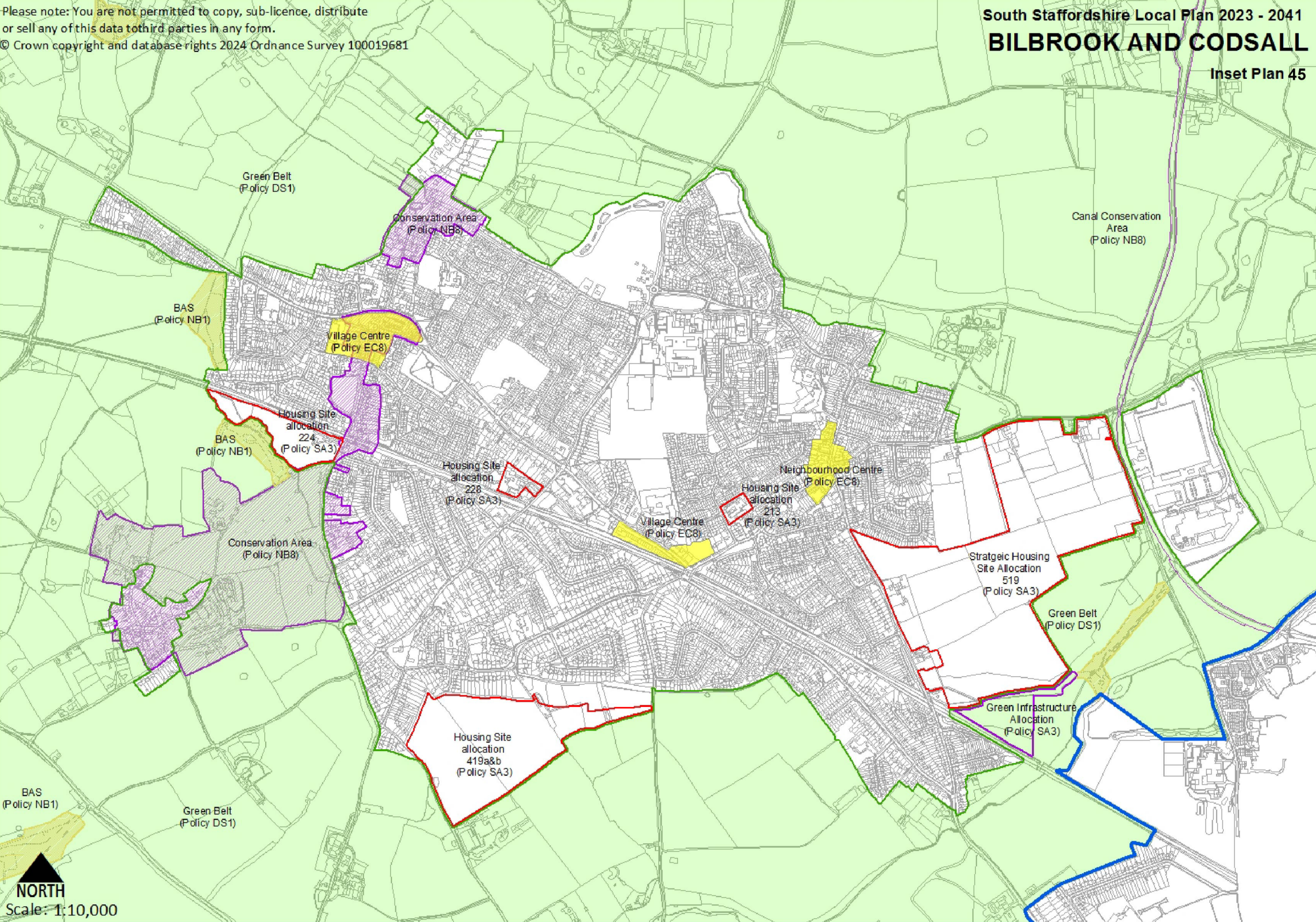
The site for the proposed new neighbourhood at Bilbrook Green is proposed as a strategic development location in the recently published draft South Staffordshire Local Plan Review as Policy SA1.
Extract from the 2024 Local Plan showing the site allocation to the east of Bilbrook - click to enlarge
Site constraints and opportunities
How local features and landscape have shaped our thinking for the proposed layout of the new neighbourhood.
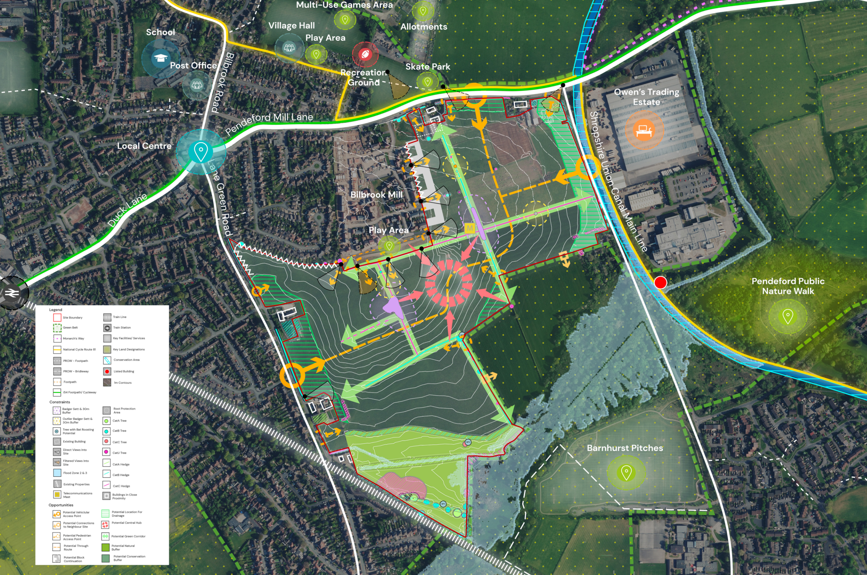
In preparing our emerging concept layout for the new neighbourhood at Bilbrook Green, we first of all considered the landscape features, topography and local context of the area. The plan below shows some of the features and constraints that have informed our emerging plans.
Site constraints and opportunities plan for the site - click to enlarge
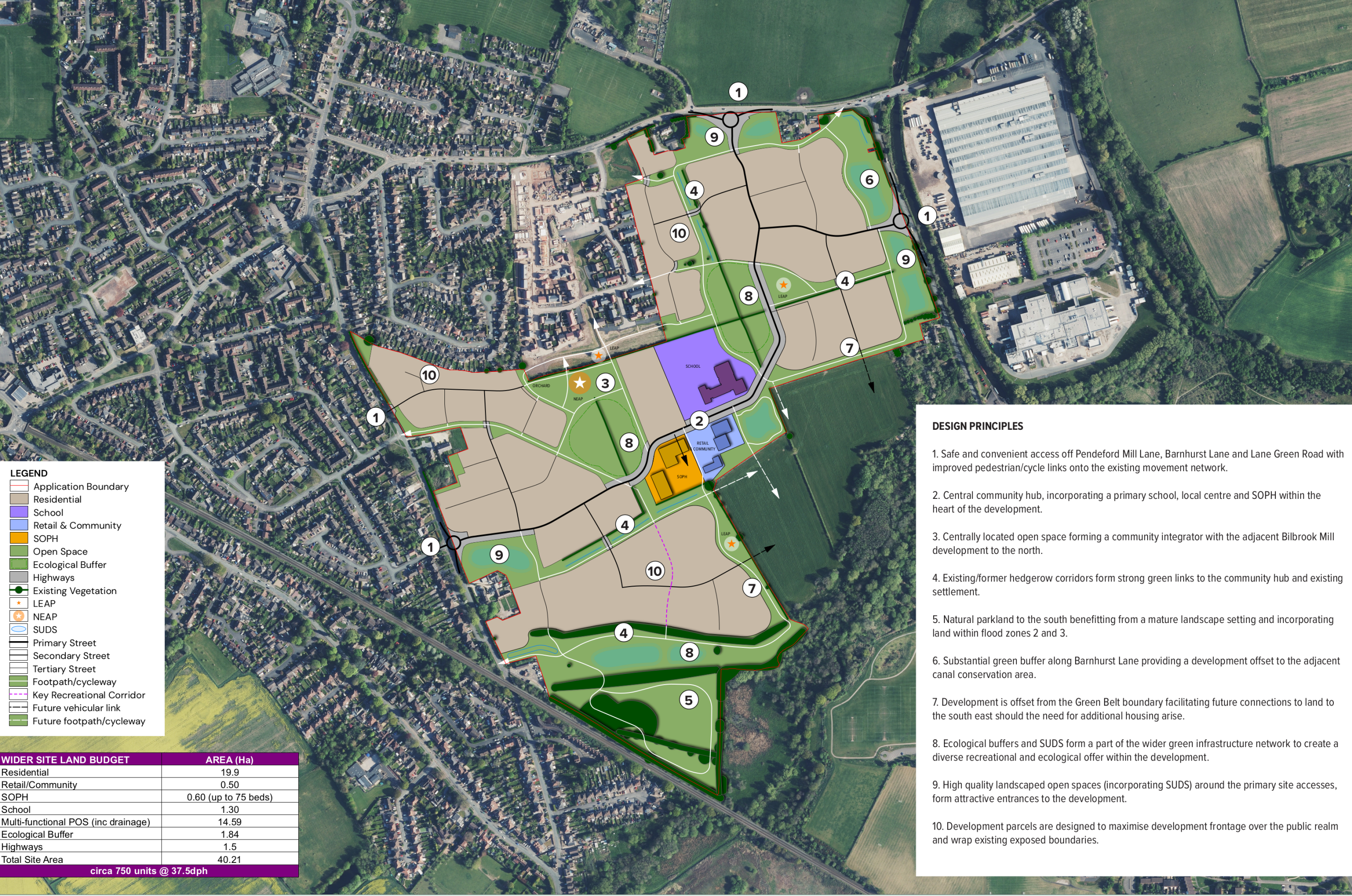
The site analysis informed design principles for the site which in turn have informed our emerging concept layout. The initial design principles plan is shown below.
Design principles plan - click to enlarge
The emerging vision for Bilbrook Green
Our emerging proposals are informed by the vision set out in the site allocation in South Staffordshire District Council’s draft Local Plan. In line with this vision, we envisage the creation of a new neighbourhood, consisting of:
- Up to 750 high-quality homes in a range of styles and tenures.
- 40% of new homes would be affordable housing, providing opportunities for key workers and people on low incomes with local connections to secure a home of their own in Bilbrook.
- The provision of Specialist Older People’s accommodation (circa 75 units).
- Homes built to the very latest standards of sustainability, with measures such as EV charging infrastructure, solar panels, and high levels of energy efficiency.
- A new First School located centrally within the new neighbourhood.
- A mixed-use local centre or community hub, incorporating potential retail provision and community facilities.
- A network of active travel routes set within green corridors and landscaped public open space.
- The retention of existing landscape features alongside extensive landscape planting and habitat creation will enhance the biodiversity value of the site.
- The creation of extensive public open space, including new public parkland and a central community piazza.
- Significant investment into local infrastructure, including the expansion of healthcare provision and a programme of highways improvements and active travel infrastructure.
- Investment into improved provision at the sports facilities to the north of Pendeford Mill Lane.
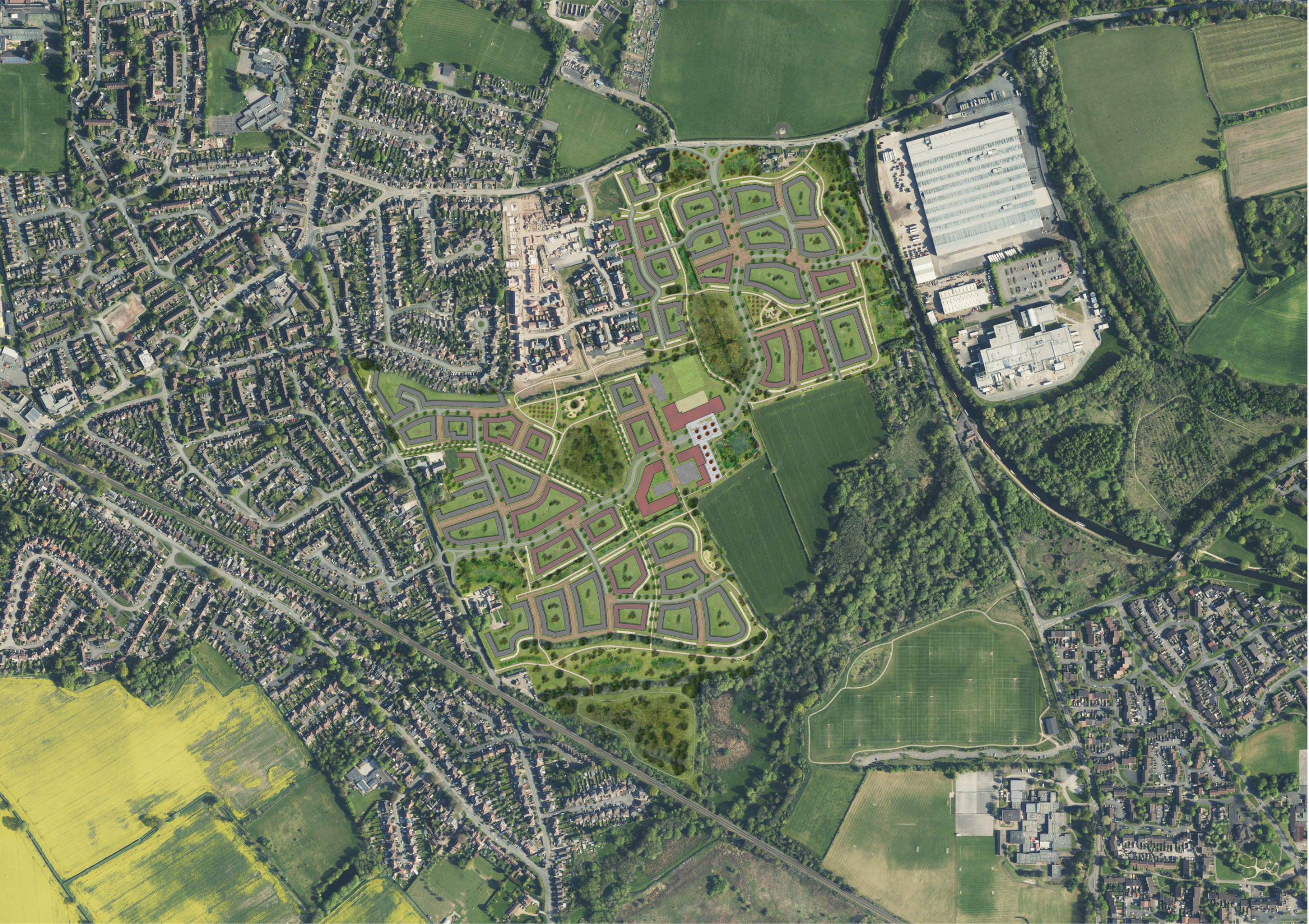
Illustrative layout. Click to open interactive map.
Investment in the wider community
The proposed new neighbourhood will generate significant investment into local community services and infrastructure, such as local healthcare provision, education (in addition to the provision of a new First School), highways infrastructure (there is further information on proposed improvements to the network later in the consultation), active travel and leisure provision.
Homes and community facilities
House types
The planning application will be an outline planning application. This type of planning application sets out the broad principles of development, such as concept layout, infrastructure and access arrangements. Details such as house types, architecture etc would be subject to subsequent further planning applications for each phase of the development (called Reserved Matters planning applications). These would involve further consultation with the community.
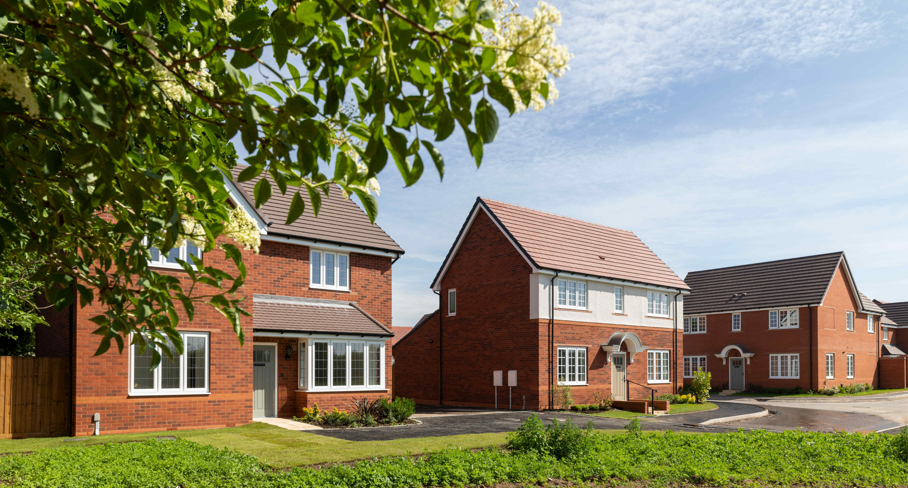
However, local people will be familiar with the new Bloor Homes development, Bilbrook Mill, which is adjacent to the proposals site. This gives an indication of some of the house types that might be provided.
Affordable homes
In line with local policy, 40% of the new homes at Bilbrook Green will be affordable homes, providing opportunities for those on lower incomes with connections to Bilbrook to secure a home of their own in the village. Affordable housing is anticipated to be provided in a mix of affordable rent, shared ownership and First Homes.
If feedback indicates a preference, we would be happy to work with South Staffordshire District Council for Local Occupancy Criteria to be applied to the affordable housing provision, ensuring that it is prioritised for people with local connections.
Sustainable homes
We want to deliver homes that our sustainable now and contribute to a cleaner, greener future.
We know that sustainability is hugely important to local people, and we will work to ensure that the new homes we deliver for Bilbrook meet the very latest standards in sustainability.
We will build homes at Bilbrook Green that consume less energy by using the latest materials and techniques to maximise insulation, air tightness and heat recovery, with the incorporation of PV cells (solar panels), creating an uplift in energy efficiency of 75-80%.
The new homes will incorporate sanitaryware and appliances that meet the highest water efficiency standards.
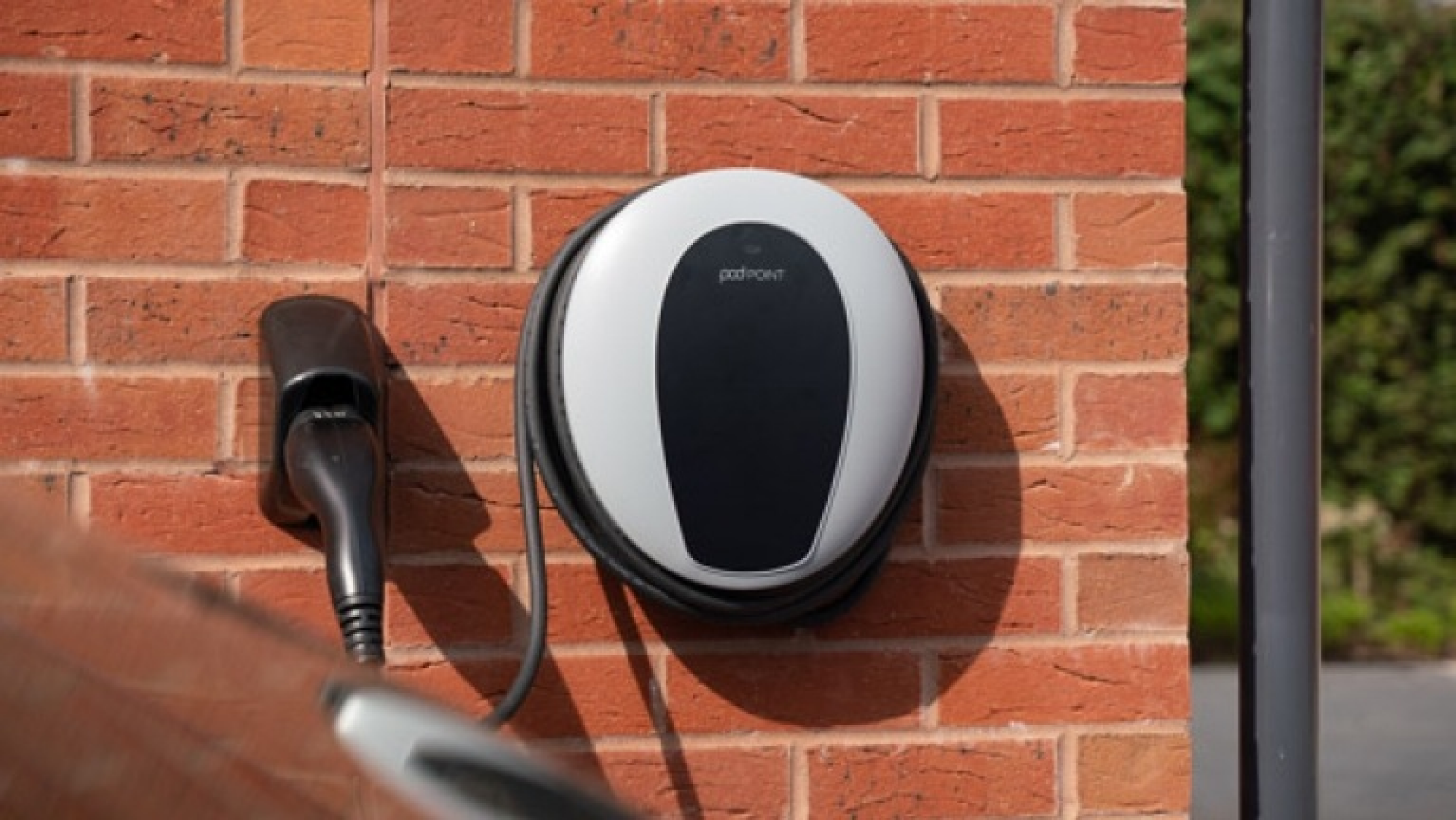
Electric vehicle (EV) charging points will be provided for all homes with on plot parking, together with access to communal EV charging points for the whole development.
To minimise the impact of construction, we always aim to procure materials from sustainable sources and recycle construction waste as far as is possible.
Community facilities - new first school and local centre
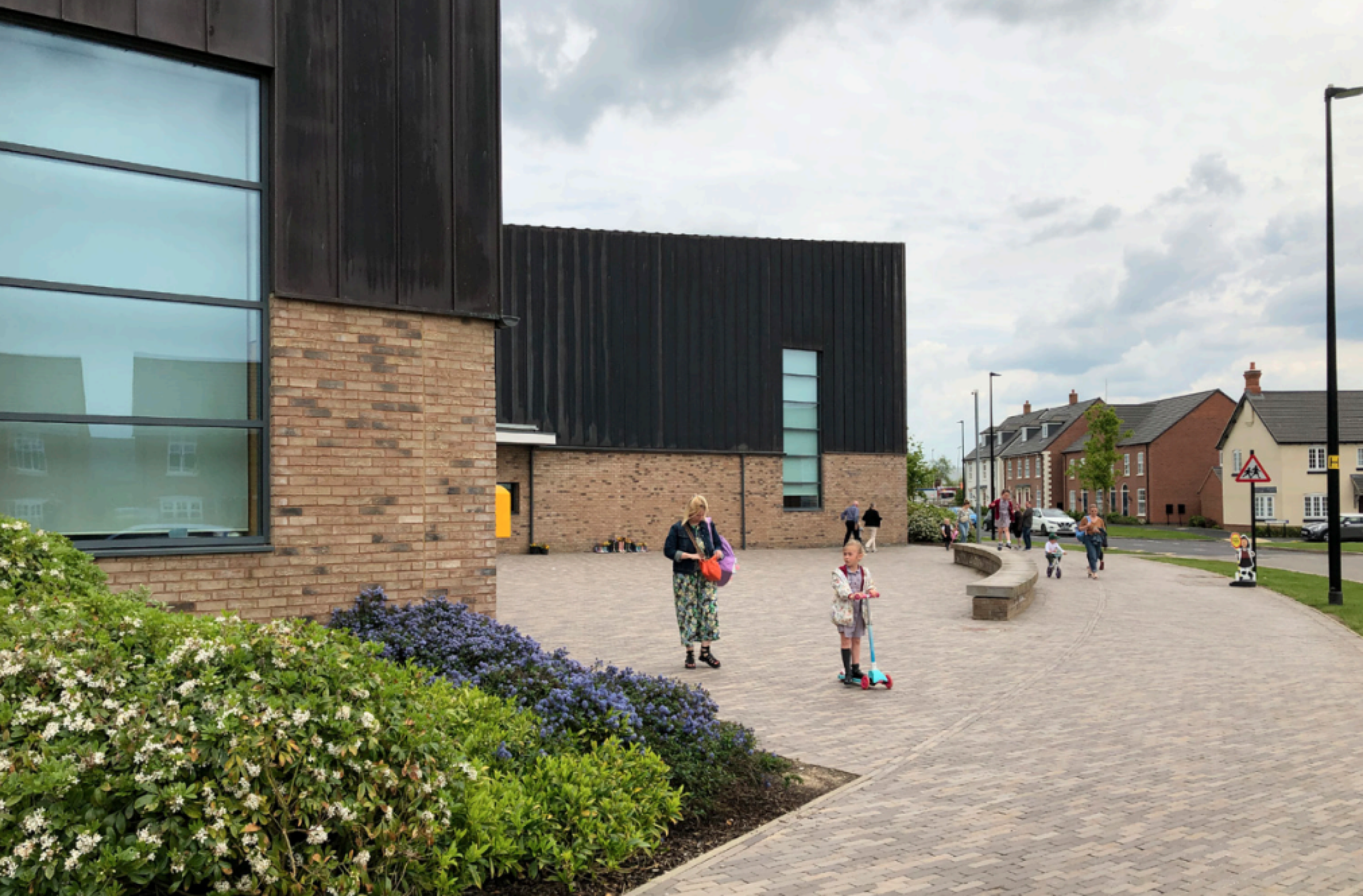
At the heart of the development will be a local centre, featuring a new first school, community space, and commercial space offering potential local convenience retail use as well as other potential commercial functions.
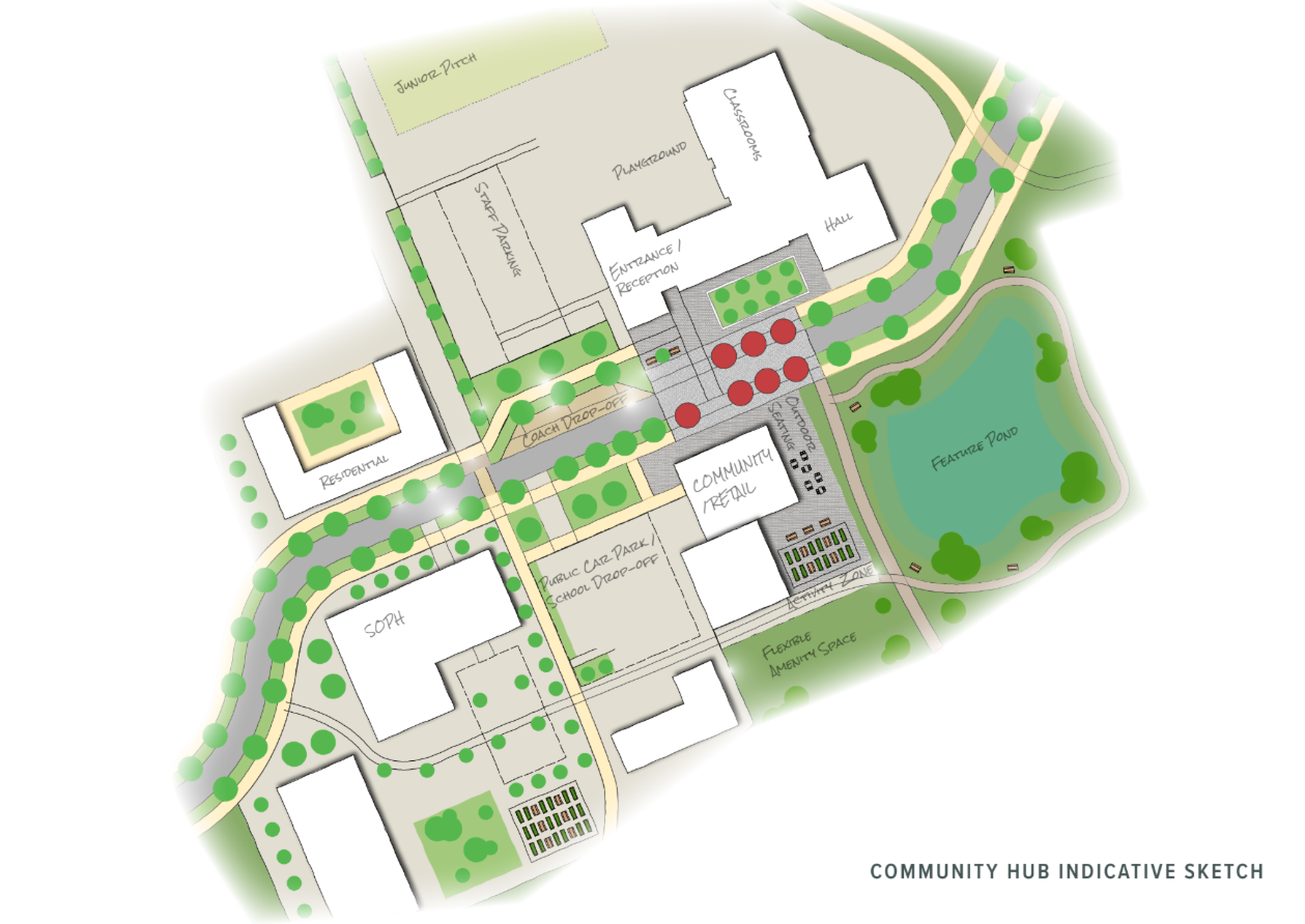
The focus of the local centre will be a new community piazza and flexible community building, which could include co-working space, meeting facilities, a café, a nursery, indoor play facilities and other services, to provide opportunities for people to work where they live. The new piazza would provide a central social space providing opportunities for community events.
Later living accommodation is also proposed to be located close to the local centre, ensuring older members of the community have easy access to facilities.
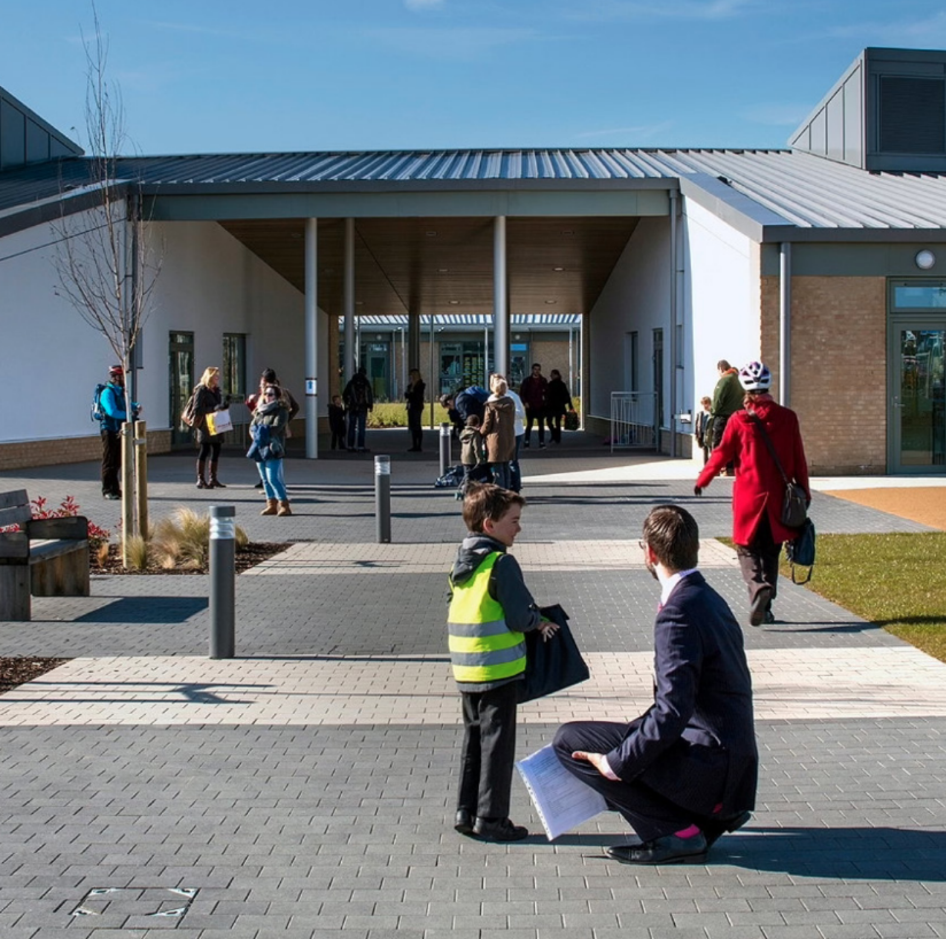
The Local Plan draft allocation proposes a new First School as part of a new neighbourhood east of Bilbrook to resolve existing longstanding pressures placed on existing schools within Bilbrook and Codsall. Our proposals will see the new First School located centrally as part of the local centre, ensuring that it is easily accessible by active travel means and potential public transport. The school’s design and location will provide flexibility for further longer-term expansion.
The following plan shows a sketch of how the local centre could potentially be laid out within the site. This is purely for indicative purposes at this stage, as the details of layout would be subject to a future Reserved Matters planning application and further consultation with the community.
Green infrastructure and biodiversity
We want to ensure that natural habitats are protected while we deliver new homes for people and families.
We are conscious of the ever-increasing importance of ensuring that development is sustainable, protecting and enhancing natural habitats and green infrastructure as much as possible whilst delivering much needed homes for people and families.
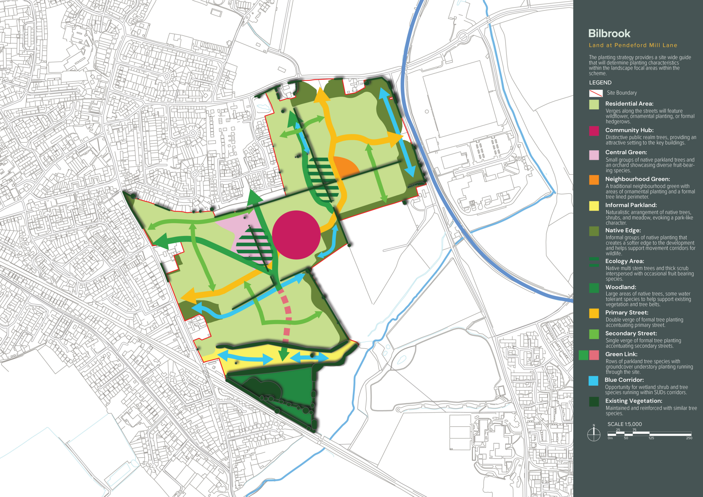
The proposals for Bilbrook Green will see more than 40% of the total site area dedicated to providing extensive areas of green space, including parkland, landscaped public open space, habitat areas, community orchards, greenways, and play areas. The proposals will be informed by an ecological survey and will seek to demonstrate Biodiversity Net Gain in excess of 10%.
This plan shows the planting strategy for our emerging concept masterplan to deliver high-quality green spaces and biodiversity net gain - click to enlarge
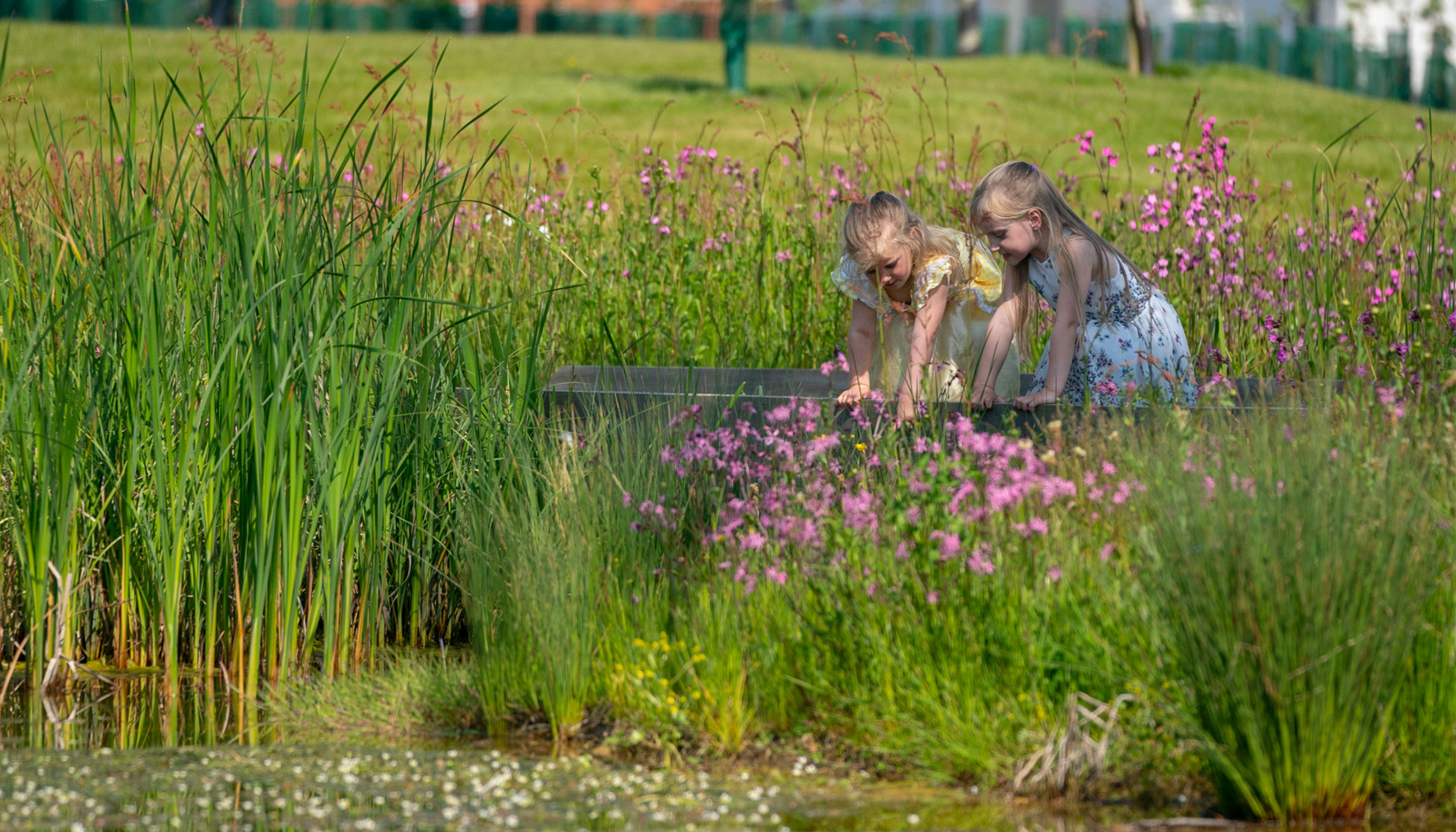
The site is currently largely comprised of improved agricultural land, which is of relatively low value in terms of biodiversity. The new neighbourhood will include the retention of existing trees and established hedgerows where practicable. This, alongside the planting of new trees and green spaces, and the creation of SuDS features to create new wetland features, will create new habitats, signficantly boosting the biodiversity value of the site.
As the green infrastructure proposals move forward to more detailed design as the planning process progresses, we are keen to work with Bilbrook Parish Council and other community groups such as Friends of Bilbrook to deliver high-quality green spaces that align with needs and aspirations of the wider community.
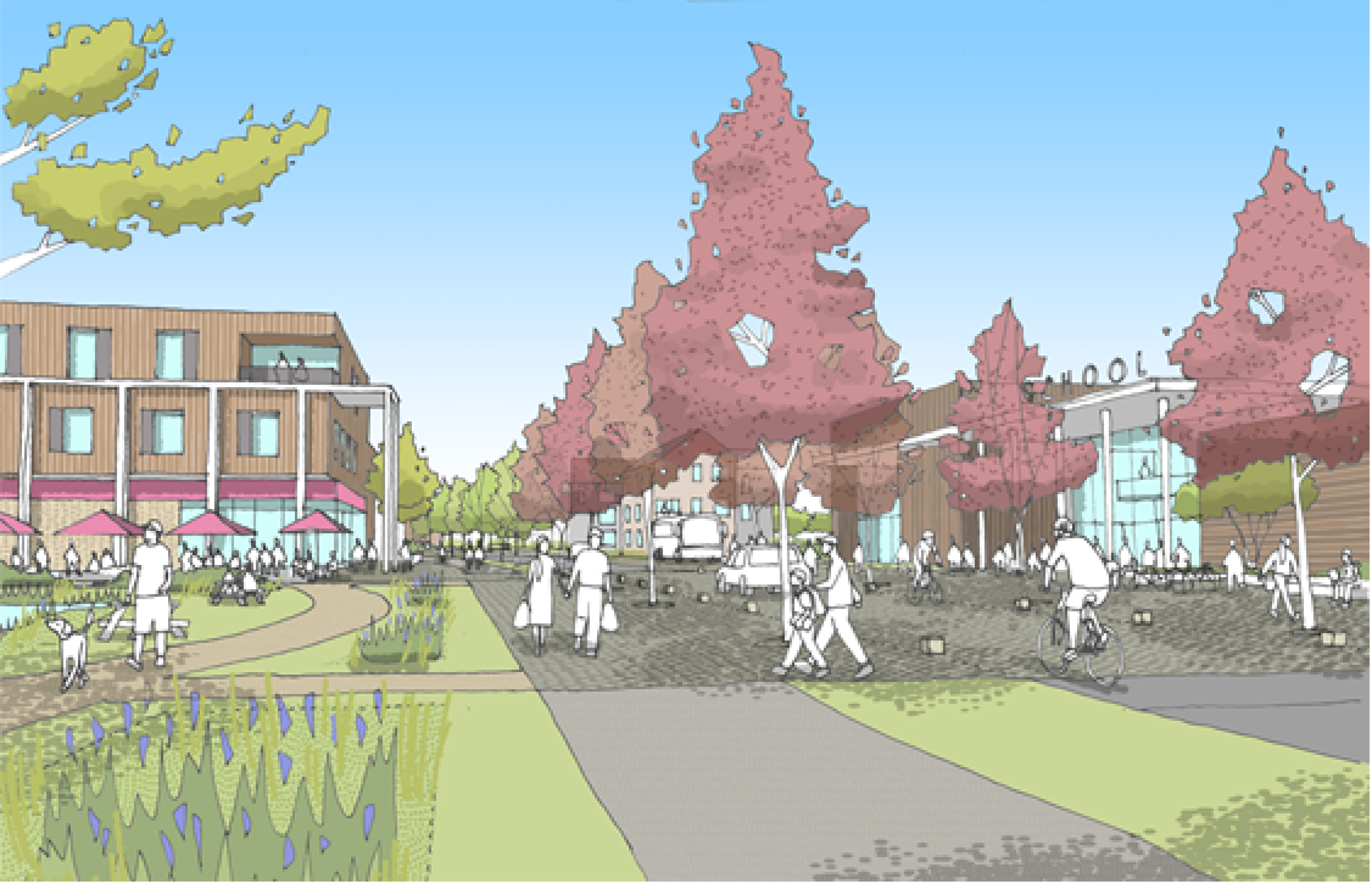
An indicative artists impression looking into the site from east of the Pendeford Mill Lane access, looking across green open space and SuDs - click to enlarge
Access and highways
Vehicular access
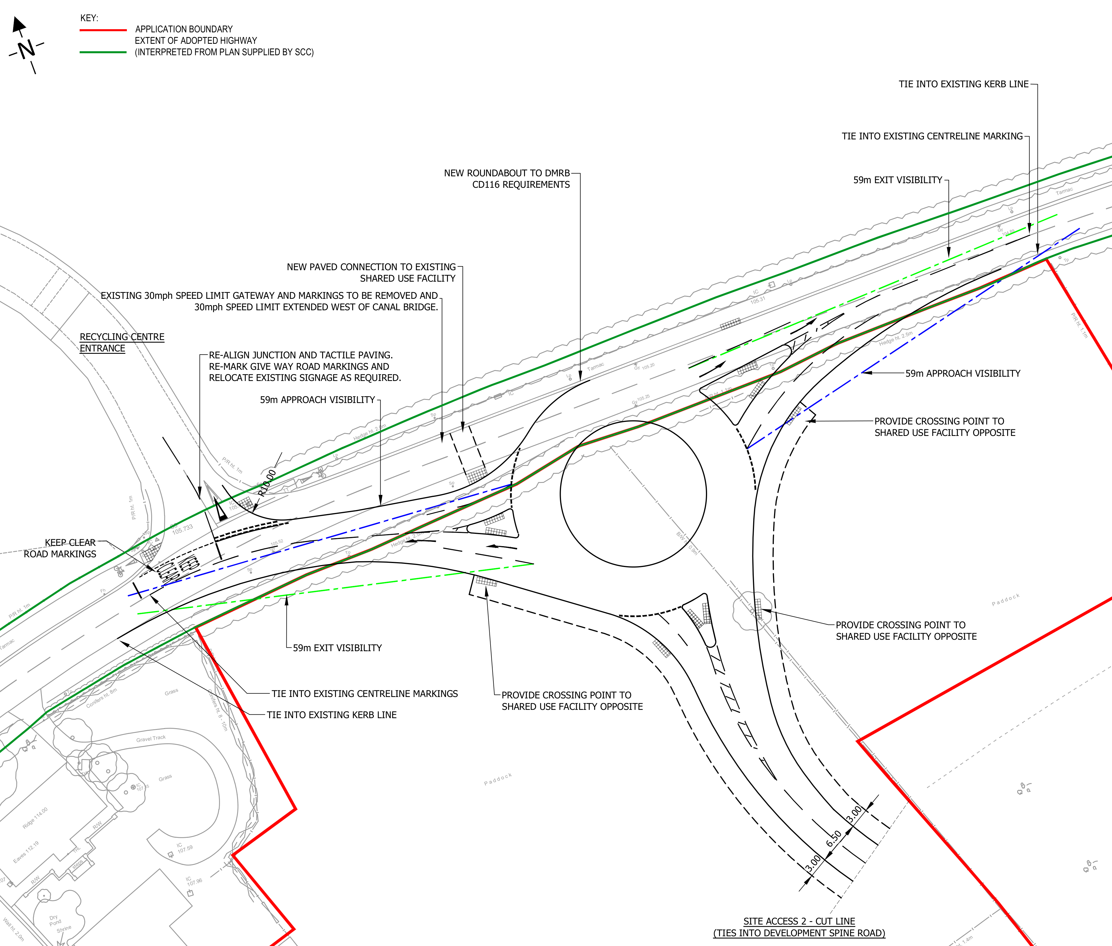
In line with the requirements set out by South Staffordshire District Council and consultation with the Local Highways Authority, primary vehicular access to the new neighbourhood will be taken via new roundabout junctions on Pendeford Mill Lane, Barnhurst Lane and Lane Green Road.
There will be a vehicular link between Pendeford Mill, Barnhurst Lane and Lane Green Road. While this primary route through the neighbourhood is intended to distribute some traffic away from the village centre, it will be designed to limit vehicle speeds such that there is no advantage in using it as a through-route. Design details could include raised junctions and zebra crossings, carriageway narrowing features at discrete locations, and changes in surface and environment within the local centre area. The primary route will also be designed to accommodate a potential future bus route.
Indicative technical drawings of the primary access points from Pendeford Mill Lane and Lane Green Road (Please note these are subject to further work with the Highways Authority and may be amended further) - click to open image gallery
School travel
The school would be located within a comfortable walking distance from the whole development and the school’s Travel Plan will focus on encouraging parents to get their children to school on foot. Walking routes to the school will also be considered in detail and additional crossing points will be provided if required to ensure parents feel the route is safe to walk.

Active travel
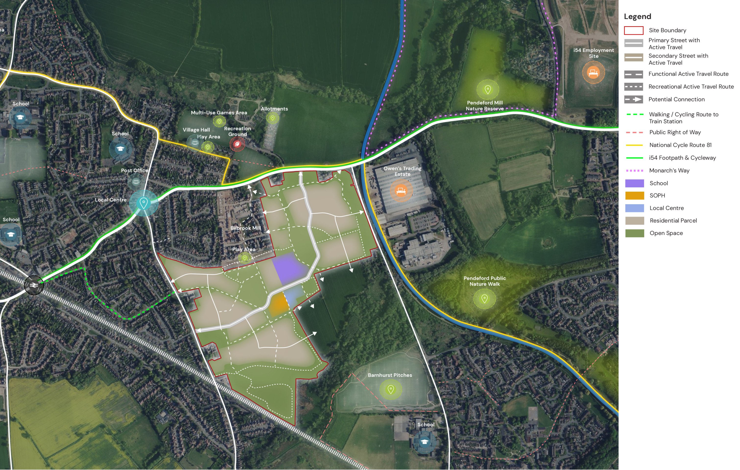
A network of greenways, cycleways and footpaths through landscaped green corridors within the site will take pressure off local roads and contribute to residents’ health and wellbeing. These sustainable walking and cycling links will connect to the wider area via Bilbrook Mill and new connections at Lane Green Road and Wobaston Road near Barnhurst Lane.
Footway and cycleway upgrades beyond the site will result in improved sustainable connections with Bilbrook Station, i54 and Wolverhampton, helping to minimise use of the private car.
There is a great opportunity to deliver improved connectivity and sustainable alternatives to private car use, including:
- Streets and green corridors designed for walking and cycling, not dominated by the private car.
- Upgraded active travel routes beyond the site to railway station, schools, i54 and Wolverhampton and the provision of new pedestrian crossings.
This plan shows the active travel network proposed within the site as well as in the wider village - click to enlarge
Wider highways improvements for Bilbrook
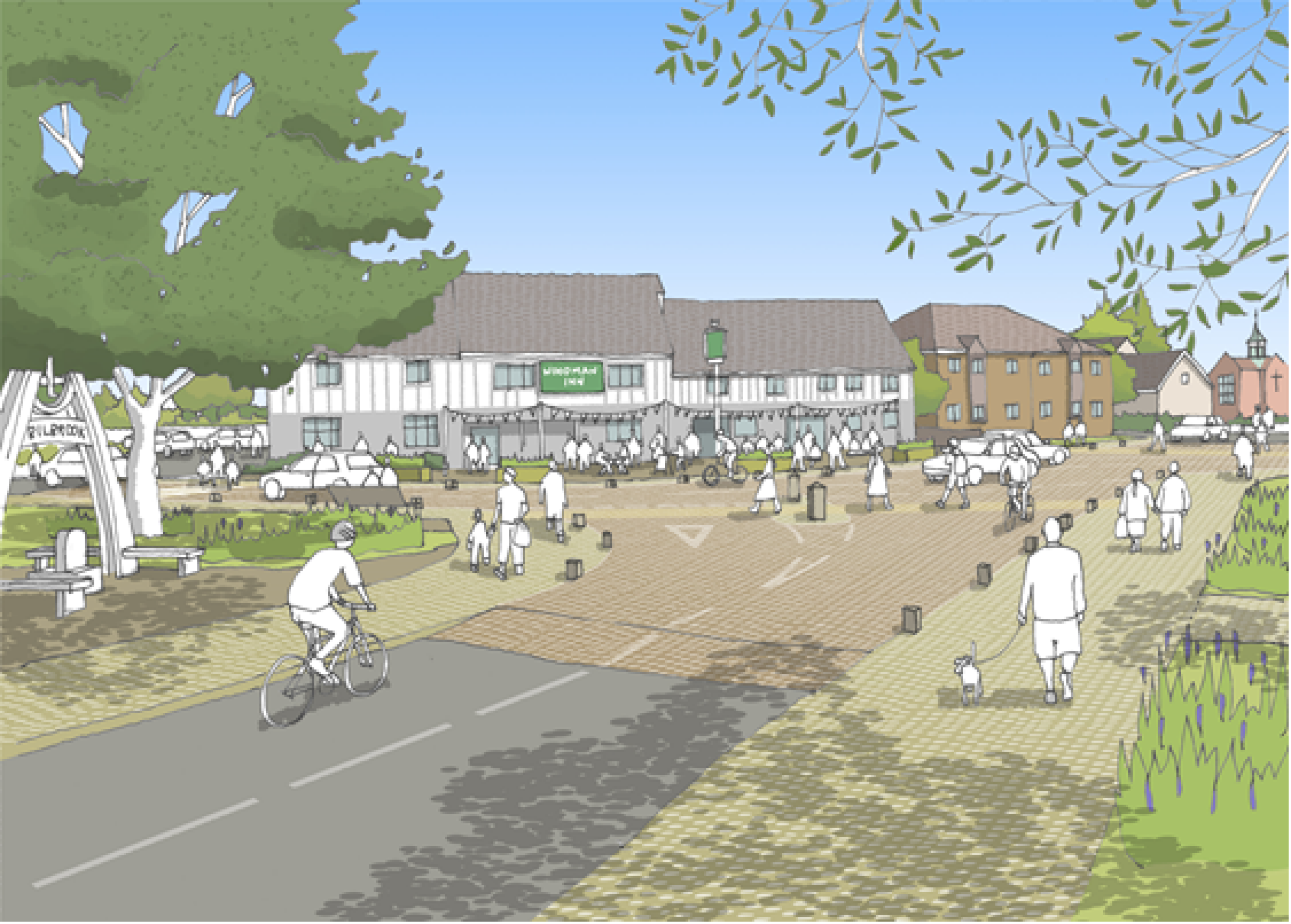
The development would generate funding for a package of local infrastructure investments. For example, we are conscious that the nearby Woodman Junction is a source of local concern, having been the top highways priority in the village’s Neighbourhood Plan survey. This is where Pendeford Mill Lane, Lane Green Road, Duck Lane and Bilbrook Road meet. We continue to work with Staffordshire County Council Highways on proposals that would see investment from our development provide improvements at this junction.
Our development will also generate investment into sustainable travel including improved bus services.
The highways improvements for the wider village to be delivered by the new neighbourhood are intended to reduce the need for car travel to local destinations and encourage active travel. Proposals include:
- Enhancements to the Woodman junction with improved crossings and waiting restrictions on the approaches. This will create a better environment for pedestrians in the village centre. By raising the entire Woodman junction onto a platform, rather than just the zebra crossings as at present, vehicle speeds will be reduced and driver awareness of pedestrians increased. This will create a safer and more pleasant environment for pedestrians, encouraging more trips to be undertaken on foot, particularly to the railway station and tto he middle and high schools.
- Wesley Road will be designated as a Quiet Route for walking and cycling to the railway station, with new signage and road markings.
- A new 4m wide foot/cycleway will be provided along the southern side of Duck Lane, connecting the proposed Wesley Road Quiet Route with the station.
- A new raised table will be provided at the junction of Duck Lane and Brookfield Road to calm traffic speeds and create a safer environment for pedestrian and cycle crossings.
- A new foot/cycleway will be provided along Lane Green Road north of the site access to encourage trips to the village centre and schools to be made on foot or by cycle.
- Additional waiting restrictions (double yellow lines) will be introduced to reduce on-street parking in the Wesley Road junction area of Lane Green Road.
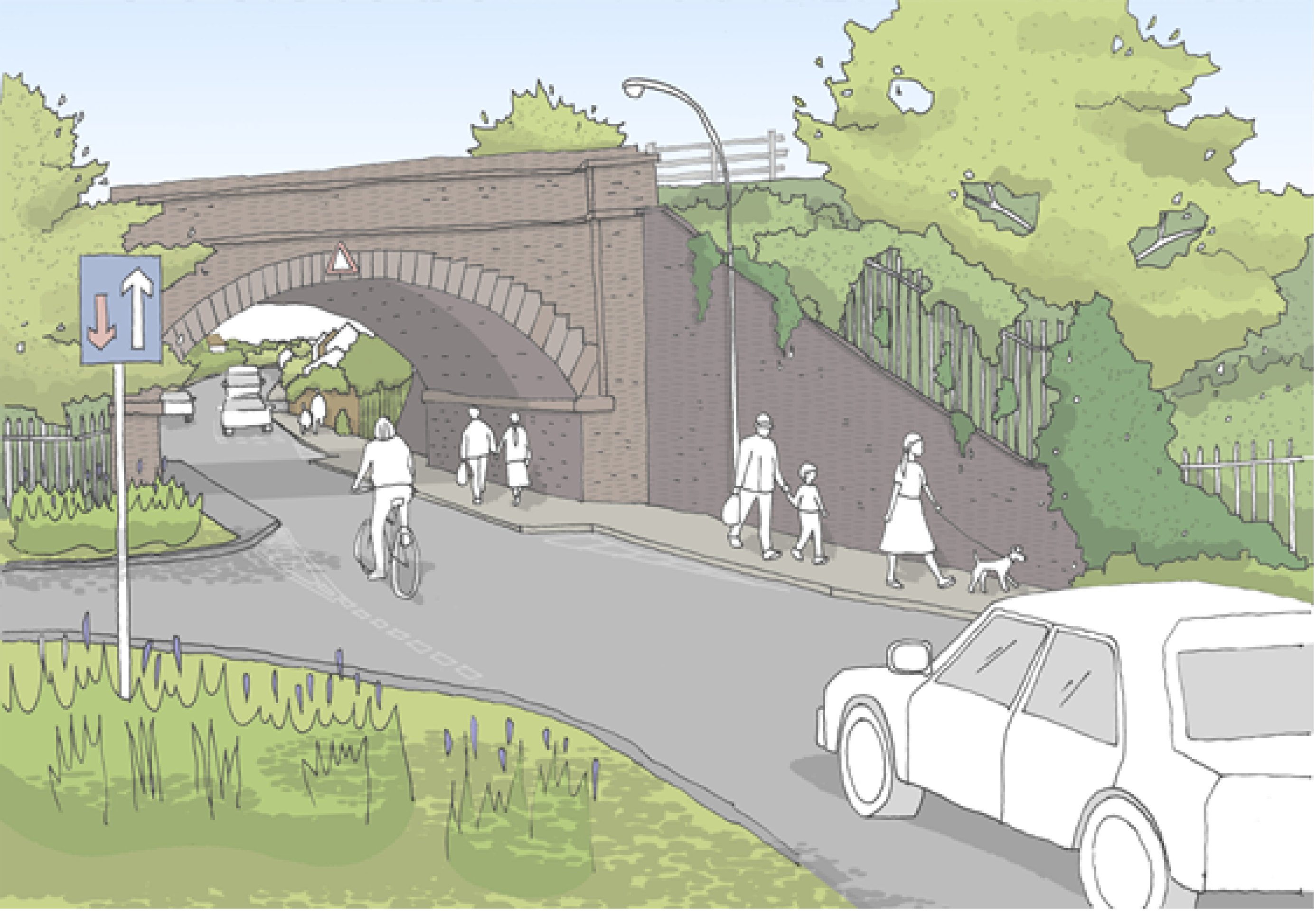
- Traffic calming/speed management measures will be delivered on Lane Green Road including engineering works at the narrow railway bridge to the south, to introduce a priority give-way arrangement reinforced with speed calming features.
- The proposed compact roundabout at the main Lane Green Road site access will also assist in reducing traffic speeds on Lane Green Road.
- A new shared-use (pedestrian and cycle) zebra crossing of Lane Green Road will be provided north of the site access.
- Improvements will be made to the footways alongside Joey’s Lane.
- A new traffic signal junction with pedestrian crossing phases will be introduced at the junction of Pendeford Mill Lane with Barnhurst Lane. This scheme will also provide additional traffic capacity to address queueing and delays.
- A new traffic signal junction with pedestrian crossing phases will be introduced at the junction of Wobaston Road with Lawn Lane.
- Improvements will be made to the cycleway along the north side of Wobaston Road to connect the development with the i54 Business Park and Wolverhampton’s strategic cycle network.
- Resurfacing of the footway along Barnhurst Lane between the proposed new access and The Droveway.
- We are also exploring potential improvements to the canal towpath between Wobaston Road and The Droveway to make it more attractive to walkers and cyclists.
You can find answers to a range of questions relating to access and highways in the dedicated FAQs section of this website.
This sketch visualisation shows in indicative view of how the proposed improvements to the Woodman Junction could look, creating a safer, more attractive environment for local people - click to enlarge
The development will fund engineering works on Lane Green Road to calm traffic speeds and create a priority give-way arrangement - click to enlarge
Flooding and drainage
The site for the proposed new neighbourhood at Bilbrook Green is located within Flood Zone 1 of the Environment Agency’s Flood Map for Planning, with areas to the south of the Site identified to lie within Flood Zones 2 and 3, associated with a tributary of the River Penk.
In analysing the site, specific hydraulic modelling has been undertaken to refine the flood extents, which demonstrate that all the proposed development is outside of both flood zones and therefore has no flood risk associated with it.
The proposed surface water drainage strategy for the development has the potential to provide an improvement over the current situation for the surrounding area, as well delivering biodiversity enhancements through the creation of wetland habitats.
Surface water drainage within the development will be managed using Sustainable Drainage Systems (SuDS). The SuDS will be located in green spaces adjacent to the proposed development and will be carefully designed to augment the proposed development’s amenity and biodiversity value. Surface water will be moved around the development to the proposed SuDS features by landscape features which will typically take the form of swales.
SuDS schemes for the new neighbourhoods will improve surface water drainage locally, whist providing new wetland habitats - click to enlarge
Other technical considerations
In preparing an outline planning application for the proposed development, a full suite of technical studies is being completed, including Highways, Flooding and Drainage, Ecology, Utilities, Noise, Heritage, Air Quality, Contamination etc. In line with the draft allocation in the South Staffordshire District Council’s published Local Plan, it is not anticipated that there will be any significant technical constraints to delivering a high quality, sustainable new neighbourhood at this site.
Planning applications and next steps
Bloor Homes is preparing an outline planning application for the new neighbourhood at Bilbrook Green, east of Bilbrook.
An outline planning application establishes the broad principles of development, such as the number and mix of new homes, community facilities, illustrative layout and access arrangements.
We would welcome your comments and feedback via our online questionnaire as we finalise our outline plans ready for submission to South Staffordshire District Council.
Once the planning application is submitted, there will be further opportunity to comment through the Statutory Consultation conducted by the Council as it considers the outline planning application.
If outline planning consent is granted, we would then prepare detailed planning applications for phases of the development. Called Reserved Matters applications, these include more detail such as architecture, materials, detailed layout and landscaping, and would be subject to further consultation with the local community prior to submission of the applications.
This would provide the community with another opportunity to provide input to ensure that the detail of the new neighbourhood further reflects local needs and aspirations.
If you would like to be kept updated as the proposals move forward, please ensure you select the “Opt-in to email updates” option when completing a feedback questionnaire.

